


Redesigning the Isle of Man
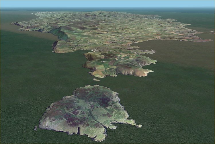
The creation of a revised Isle of Man scenery for FS was a major challenge as it involved a redesign of the whole island. A full coastline rebuild was essential before any further interior work could be completed because of the default coast was incorrectly located and of extremely poor resolution. Because of the proximity of the airports (especially Ronaldsway) to the sea it was impossible to ignore the default errors. Once the coastline rework was completed it was then possible to add further island detail and the airports at Jurby, Andreas and Ronaldsway.
The island strongly benefits from having a good terrain mesh to produce the hills that are sadly lacking in the default scenery. VisualFlight has created an excellent mesh for the whole of the UK - but any good SRTM mesh will be much better than the FS default. See AVSIM or Flightsim for UK SRTM mesh by Pietro Mauri or Eddie Denney.
The second major FS development for the UK has been the release of the VisualFlight photographic scenery. I cannot speak too highly of this as it replaces the default landclass ground cover in FS2004 with true, accurate photographic textures - as you can see in the screenshot above.
I have created separate versions of the scenery for VFGM and non VFGM scenery users. The latter is basically the same but it includes an airport polygon and suitable exclude files to trim away some of the excess (and fictitious) autogen buildings in the default scenery.
Scenery Content
The scenery features:
1. A fully revised and accurate Isle of
Man coastline.
2. Isle of Man scenery objects - including trams, follies, towers, shipping,
piers, Laxey Wheel, masts etc.
3. Detailed airfield scenery for Andreas, Jurby and Ronaldsway airports.
4. AFCAD files for all three airports.
Scenery Information
Island
There are quite a few objects to explore around the island, some of them animated. The lighthouses flash correctly regarding timings but do not show correct sequences. Langness should send two short flashes every 30 seconds but the result was just one long flash and so I limited all to a single pulse..
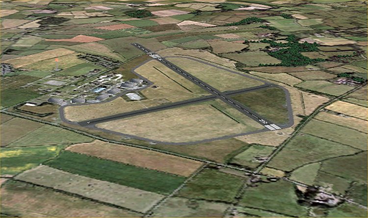
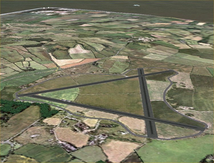
Jurby
Jurby has an operational Tower frequency of 125.30. Runway 08/26 is in use and is 4200ft long - BUT it has a public road running across the runway so beware of the displaced threshold and the fence across the runway.
Andreas
Andreas has no runway markings as it has only recently become active. Only two of the three runways are operational (12/30 and 06/24), the third runway has agricultural buildings on it. I have given Andreas a fictitious Tower frequency of 123.45.
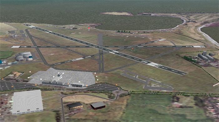
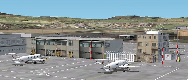
Ronaldsway
Ronaldsway is shown in great detail and may slow frame rates down if AI is also in use. All airfield signs are correct as are the apron stand markings. Terminal buildings are accurate representations but most of the southern airfield structures have yet to be made in GMax. The AFCAD adds the new ATIS frequency of 123.875.
Both ILS frequencies are the same - 111.15 for 08 and 26. The RWY NDB has been repositioned to the south of runway 08/26.
Note: Be careful with 08 approach as the ILS is offset by 3.75 degrees north of FAT. The localiser is situated on the grass to the south of the runway so an ILS approach will be both offset and will take you through the runway centreline at about 2nm from touchdown.