


FS Scenery
Coastline Correction
Overview
The default coastline in FS2002/4 may be better than previous versions of the sim but it is still in need of revision. The coastline is inaccurate - it is offset and also it is quite low resolution.
Before you can start rebuilding the coastline you need accurate data. This can be awkward because the data comes in degrees of resolution and can be aligned to different grids (see the Grid Datum page).
Data Accuracy
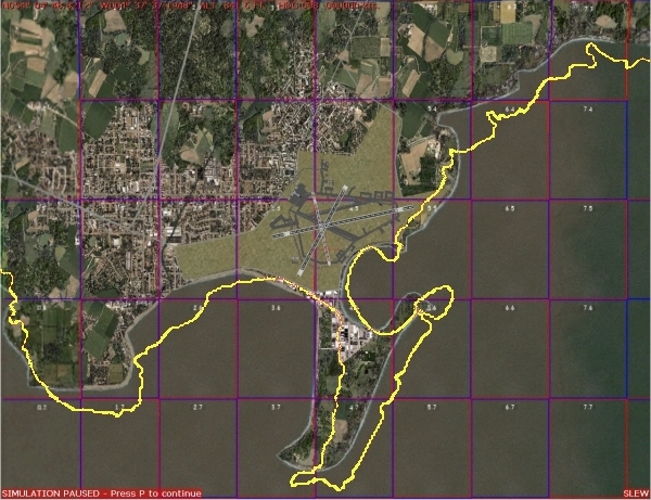
In the screenshot below the default FS scenery shows the southern section of the Isle of Man and the default Ronaldsway airport. Aeronautical data in FS is based on the WGS84 grid and the runways shown will have been obtained from the Jeppesen WGS84 database.
The threshold of runway 26 is only be 45m from the real coastline but the default FS coastline is much further away than that. The correct WGS84 outline relative to the airport is shown in yellow.
Unfortunately WGS84 data is still quite hard to find. Most FS users will use data aligned to the OS grid or might use NOAA data imported into ASD. Both are likely to cause problems if coastline accuracy needs to be very high (as it does in this example).
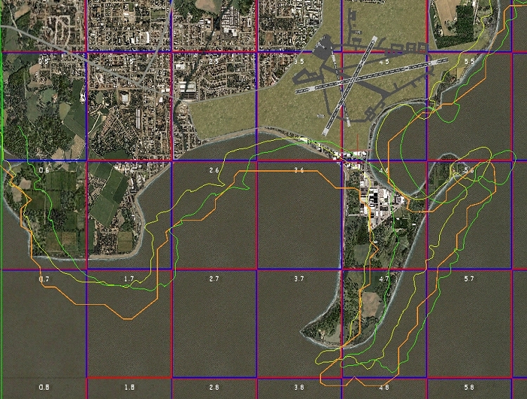
It may look confusing but I hope you can pick the bones out of the diagram above. There are four separate coastlines shown on the image.
|
FS
Coastline
|
- the default FS scenery is shown in full. |
|
NOAA
coastline
|
- if using NOAA data the coastline is marked by the ORANGE profile |
|
OS
coastline
|
- if using any OS reference source the coastline is marked by the GREEN outline. |
|
WGS84
coastline
|
- as in the previous screenshot the WGS84 coastline is marked in YELLOW. |
The default FS scenery is based on DCW (Digital Chart of the World) data and is by far the lowest resolution data as well as being offset north and west of the WGS84 reference datum.
The NOAA coastline is of slightly better resolution but it's digital format results in "jaggy" lines even on straight sections of coast - these can be very messy to correct. The NOAA coastline is offset south and east of the WGS84 datum.
OS data can be of high resolution but WGS84 and OS grids are not aligned. As a result an OS coastline will have an offset of approximately 300 feet on a bearing of 100°. This offset varies across the UK.
How FS scenery works
The world in FS is divided into a 768 x 512 grid (called LOD 8 cells) and each LOD 8 cell is further divided into a set of 32 x 32 LOD 13 cells. It is these cell boundaries that are shown in the screenshots.
Essentially all these LOD 13 cells in FS are water by default. Some are changed to land cells via the Landclass technique to create a rough "block" covering the land masses of the world. For each LOD 13 cell that has a coastline passing through it a further modification is made - the coastline is drawn as a VTP (Vectored Terrain Polygon) and the areas either side are classified as "land" or "water" using LWM's (Land and Water Masks). Remember these terms as they become important later.
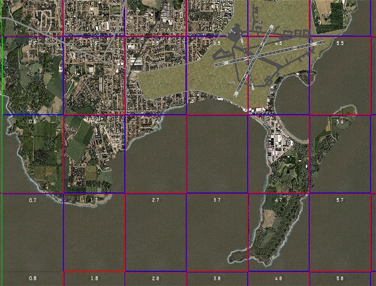
You can see this process by opening the Scenery Manager and disabling the NWEurope scenery area.. This removes the coastline data and leaves you with the basic Landclass "blocks" that FS is built on prior to the coastline data being added.
Making new coastlines
Thanks to the excellent work by Iain Murray it is now possible to create new coastline sections to replace the default data. Iain's Coastline Maker tool is easy to use although the process itself can be time consuming if you have a large area to cover.
You don't have to edit each LOD 13 cell individually but you can see that the end result, in terms of resolution, will depend upon how many cells you decide to show on your screen during the redraw process.
I won't go into the process at all here as Iain has included a perfectly adequate tutorial with his program. Instead here is a screenshot of the same area of coastline after using Coastline Maker to redraw it to WGS84 boundaries. This is an unfinished stage of the rebuild - you will see some LOD13 cells have produced the revised coastline are missing the surf.
Special Properties of the Coastline
Having redrawn the coastline to the WGS84 datum it now fits geographically with the default FS airfields and navaids. Progress is being made - but there is a further stumbling block. The coastline has special properties that affect other scenery elements - especially any terrain mesh.
Click
on the Next button for Part 2.