


FS2004 Scenery
GPS and Map Errors
Problems using chart and GPS data for designs
The two airfields illustrated in the screenshots below are Jurby and Andreas on the Isle of Man.
Andreas (top) was created from GPS readings taken from each threshold. Jurby was created from supposedly accurate airfield drawings with Lat/Long values converted from OSGB36 to WGS84.
Both airfields have been compiled without the airfield polygons so that the runway layout can be directly compared with the VFGM scenery.
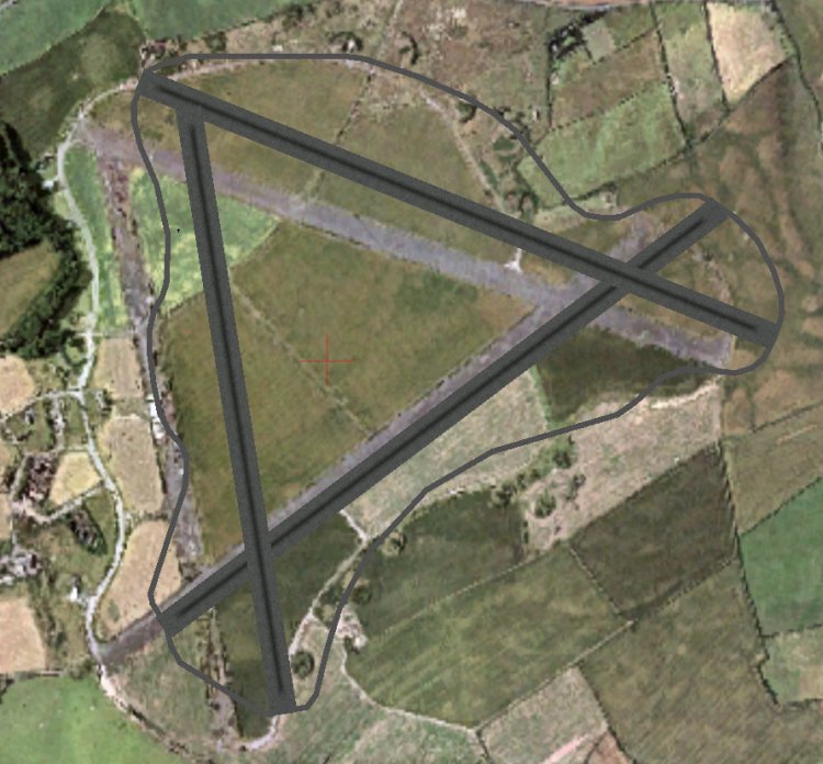
Andreas airfield Long disused but it is now active with microlights and gliders. The airfield is offset by quite a margin. GPS has been useful in that the layout is accurate but the runways need rotating very slightly anticlockwise and the whole airfield layout needs moving southwest. The offset is approximately 440ft. I can't offer any sound reason why the offset is so great from (theoretically) accurate GPS data - a Garmin 196. For most purposes (including flying) it would be accurate enough but scenery design demands much higher accuracy!
|
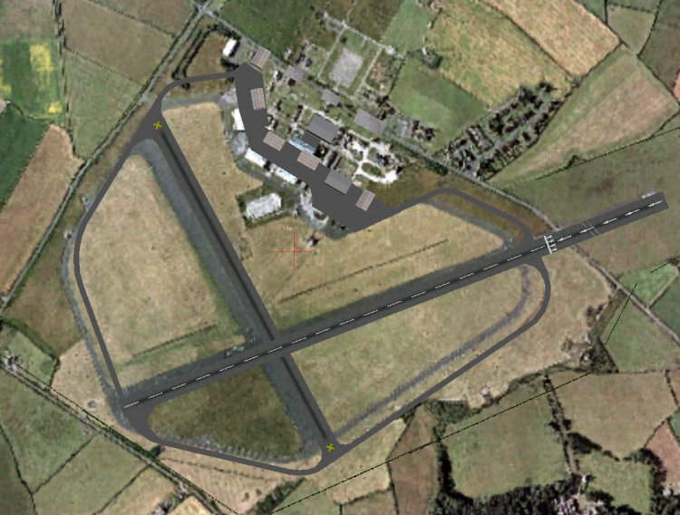
Jurby airfield In very good condition but is now only used for non aviation activities. Prison now on site (not shown). Here the runways are more accurately located but will still require adjusting. The slightly oversized scenery is a hint that the airfield may have been built using a photocopied map (it was, but I only discovered that afterwards). This is a common problem - copiers may create stretched or oversized copies, sometimes in length only but also in length and width as shown above. Note:
The original WW2 tower is just to the right of the red centre cross
and was still used when Jurby was active (occasional flying displays
and air races up to 2000). Above and to the left of this is the
hangar base for the ill fated Airship Project which folded before
the first airship was completed. Only the base remains now - the
structure was dismantled several years ago. |